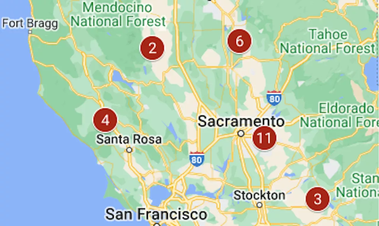
The two biggest had passed 15,000 acres.
On Tuesday, the fourth day of dry, windy weather across much of California, 11 wildfires of more than 300 acres were burning in the state — and two were more than 15,000 acres.Aero Fire map: Evacuation ordered as wildfire nears Copperopolis
The map above shows the location of the largest fires that were burning at the start of Tuesday; by the evening, three were completely contained., started June 17; 126 acres, 90% contained. A Tuesday report from the Bureau of Land Management fire team put the size at 350 acres.
This Slate Belt kid once knocked on Willie Mays’ door to say ‘hey.’ What happened next was the thrill of a lifetime.
United States Latest News, United States Headlines
Similar News:You can also read news stories similar to this one that we have collected from other news sources.
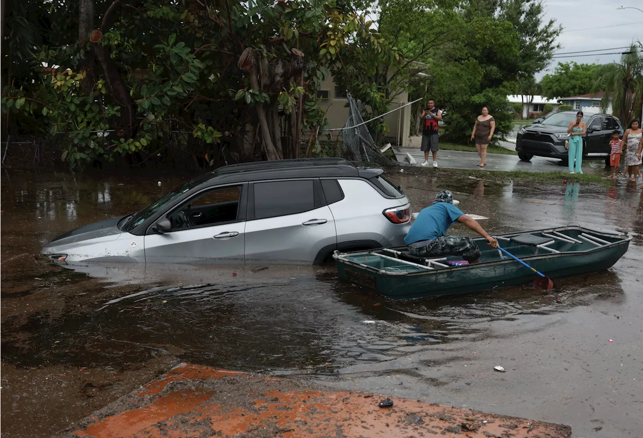 Map Shows Florida Community Drenched in Over 2 Feet of RainSouthern Florida was doused this week, as flood warnings were issued throughout the state.
Read more »
 Map Shows China's Military Drones Partially Encircling Neighbor's TerritoryChinese unmanned aerial vehicles are now part of near-daily military operations in Taiwan's air defense zone.
Read more »
 LA Jacaranda MapThe most important stories for you to know today
Read more »
 What the climate zone map can tell you about a plant’s growth potentialJoshua Siskin travels up north and gets some perspective on Southern California plants.
Read more »
What the climate zone map can tell you about a plant’s growth potentialJoshua Siskin travels up north and gets some perspective on Southern California plants.
Read more »
 Map shows which parts of N.J. will be underwater in the future. Look up your address.Check out NOAA's interactive map to see your level of risk.
Read more »