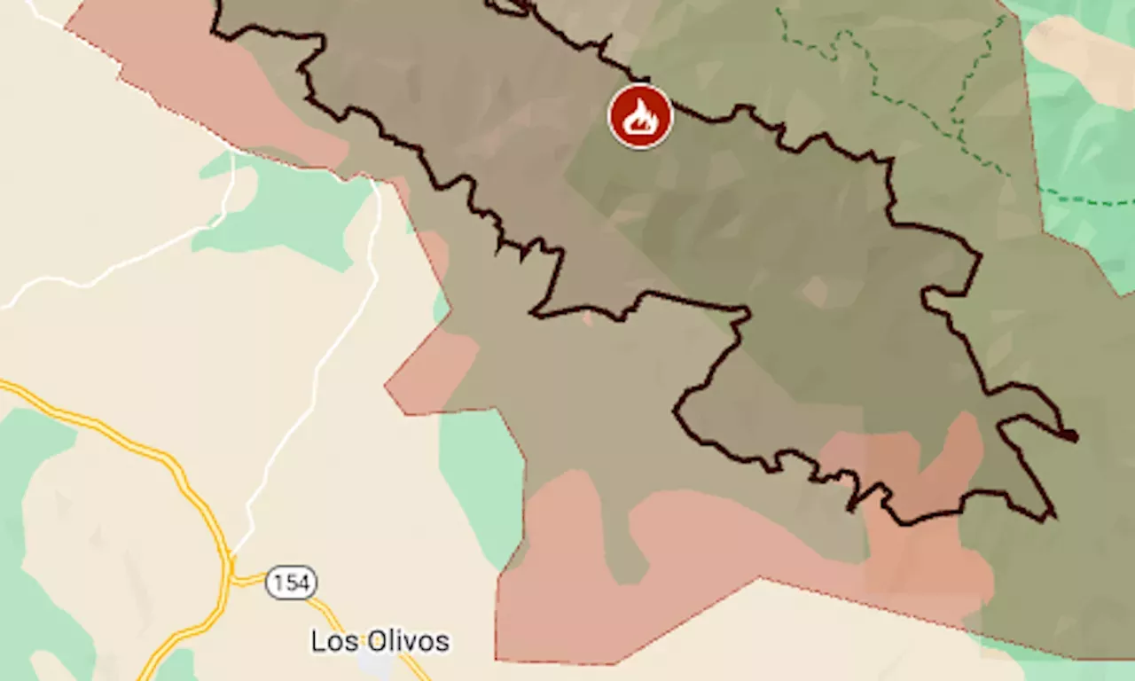
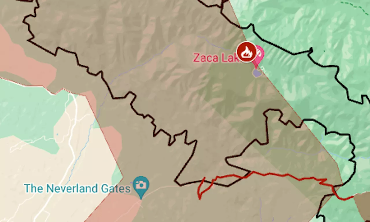
The map shows the approximate fire perimeter as a black line and the evacuation zone in red.
The evacuation zone for the Lake Fire, burning in a rugged area of Santa Barbara County, has expanded for three straight days and now covers more than 130 square miles.Wayside fire causes Richmond BART station closure, train delays
Most of the growth Tuesday was toward the southeast, into a wilderness area, CalFire said. The evacuation order now extends to the outskirts of Los Olivos, within 5 miles of Solvang. The fire started around 4 p.m. Friday, July 5, near Zaca Lake, in Los Padres National Forest. Its cause is under investigation.
United States Latest News, United States Headlines
Similar News:You can also read news stories similar to this one that we have collected from other news sources.
 Map: Lake Fire in Santa Barbara County grows to biggest of the wildfire seasonSo far this year, the state has had six wildfires over 10,000 acres. Last year at this time, its biggest fire was 1,560 acres.
Read more »
 Map: Lake Fire in Santa Barbara County grows to 2nd biggest of the wildfire seasonAs of Sunday afternoon, the fire was at 16,452 acres (25.7 square miles) with 0% containment, CalFire said.
Read more »
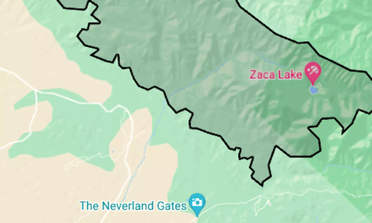 Map: Lake Fire explodes in Santa Barbara County mountainsIts western edge was within a mile of the former Michael Jackson Neverland Ranch, as well as several prominent wineries.
Read more »
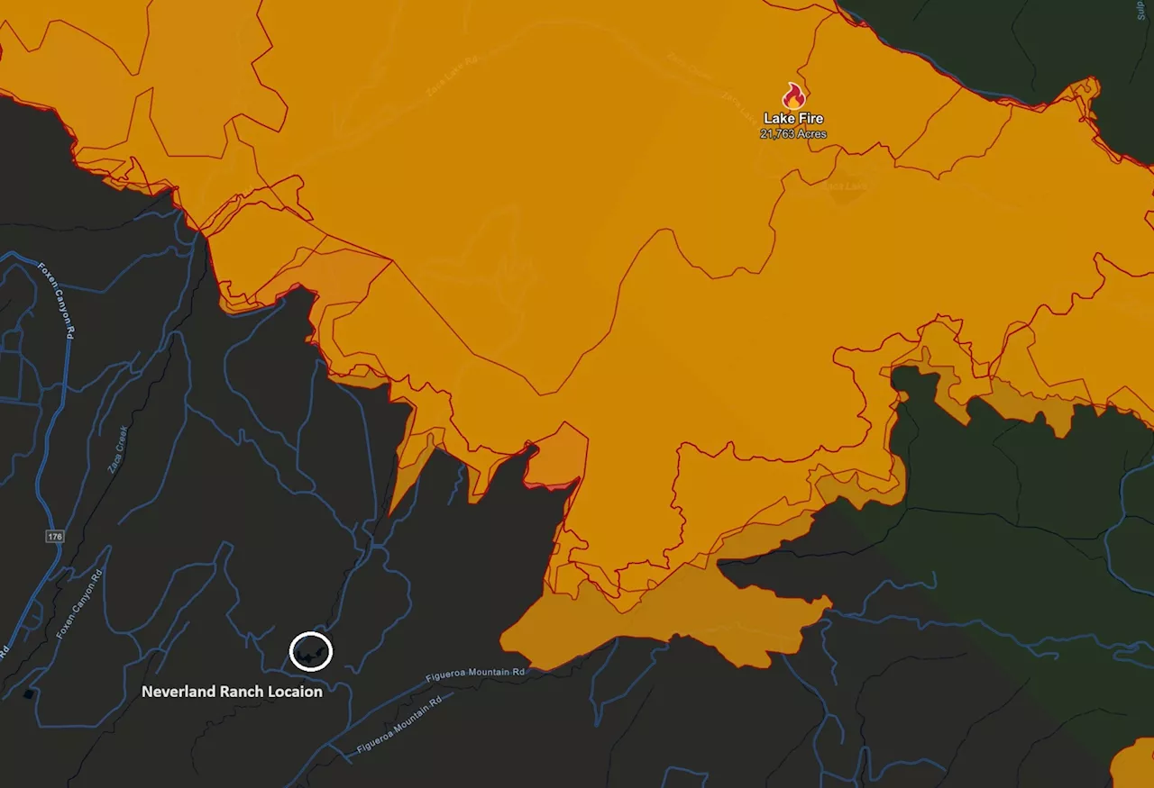 Wildfire Map Shows 'Lake Fire' Nearing Michael Jackson's NeverlandSanta Barbara's 'Lake Fire' has forced an evacuation order on the area and surrounding ranches.
Read more »
 California Wildfire Map Shows Fires as 66,000 Acres BurnHundreds of people have been evacuated as wildfires burn across thousands of acres in California.
Read more »
 Map: Thompson Fire perimeter and evacuation zone near Lake OrovilleAbout 10 square miles on the lake’s west shore remained under the order, down from almost 50 square miles.
Read more »