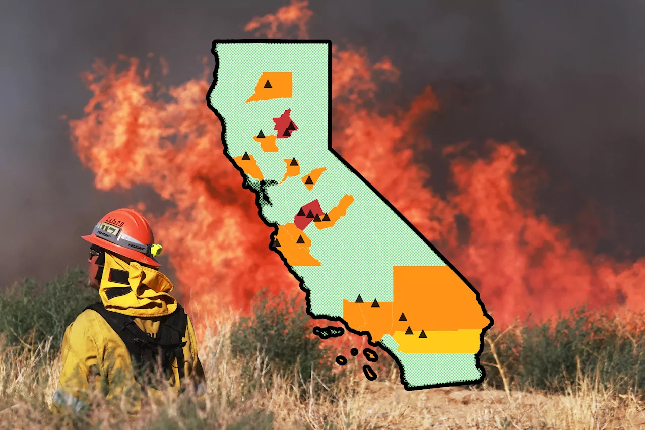
Hundreds of people have been evacuated as wildfires burn across thousands of acres in California.
An interactive map by the California Department of Forestry and Fire Protection shows where active fires are burning in 14 counties across the state. So far, more than 66,000 acres of land have been burned.The website said that there have been more than 270,000 emergency responses to deal with roughly 2,100 wildfires. Twelve structures have been destroyed while nine others have been damaged.
The second-largest fire, named the Sites Fire, is burning in Colusa County and has spanned nearly 9,000 acres.The third largest, the Aero Fire, is in Calaveras County and has burned more than 5,000 acres. These two fires are 0 percent contained. Each of the other active wildfires currently cover about 1,000 acres or fewer.
United States Latest News, United States Headlines
Similar News:You can also read news stories similar to this one that we have collected from other news sources.
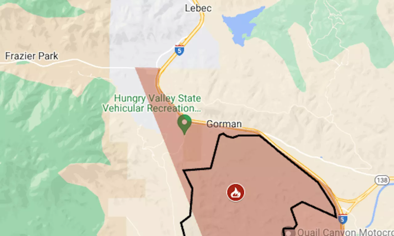 Post Fire map: Evacuation for biggest wildfire of California’s seasonWildfire in Los Angeles and Ventura counties has reached Pyramid Lake, along I-5’s Grapevine section.
Read more »
 Interactive Map Shows California Heat Warning—Check Your AreaThe National Integrated Heat Health Information System issued its highest level of heat warning for the Pacific Southwest.
Read more »
 Map Shows California Cities Will 'Roast' From HeatwaveMuch of the state has been slapped with an 'excessive heat' warning, with temperatures predicted to soar into triple-digit figures.
Read more »
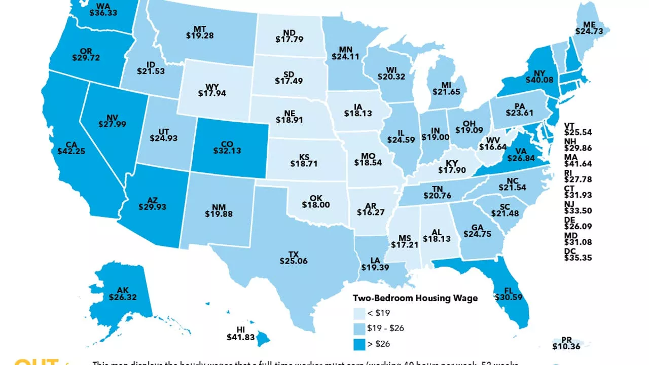 This map shows the hourly wage needed to afford rent in CaliforniaA new study conducted by the National Low Income Housing Coalition (NLIHC) looked at the hourly wage needed to afford rent in every state and to no one’s surprise, California topped the list.
Read more »
 This map shows how much you need to earn to afford rent in CaliforniaA new study conducted by the National Low Income Housing Coalition (NLIHC) looked at the hourly wage needed to afford rent in every state and to no one’s surprise, California topped the list.
Read more »
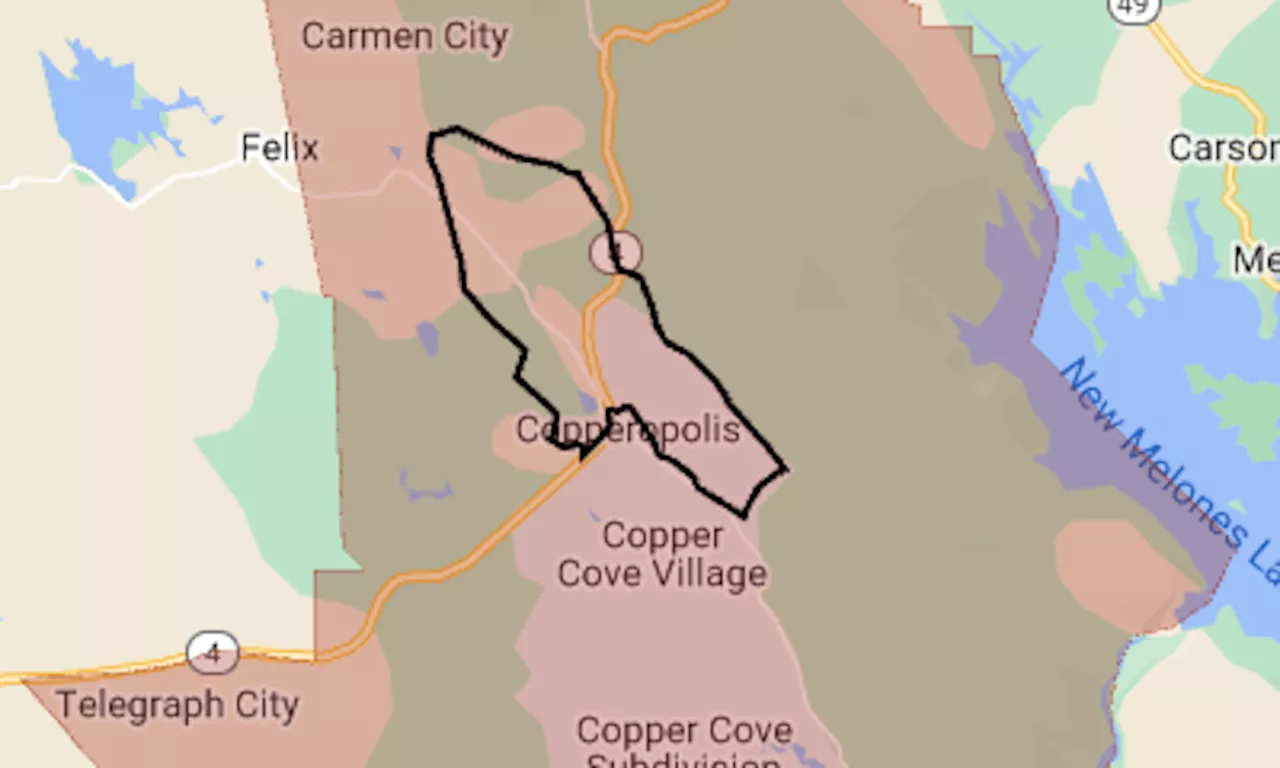 Aero Fire map: Evacuation ordered as wildfire nears CopperopolisThe map shows the evacuation area in red. The black line indicates the approximate perimeter of the fire.
Read more »