
An interactive map shows how Washington's extensive coastal regions could be at risk as sea levels rise due to climate change.
A new interactive map shows how parts of Washington state could be submerged underwater as sea levels rise due to climate change.Washington's extensive coastal regions, which stretch around 157 miles along the Pacific Ocean, would be particularly at risk, according to the map.The United Nations' Intergovernmental Panel on Climate Change projects that by the year 2100, global sea levels could rise by up to 3.6 feet if global greenhouse gas emissions are not mitigated.
Sea level rise is primarily caused by the melting of ice caps into the ocean due to warming temperatures. The level at which sea levels will rise will be impacted by whether global action is taken to slow climate change.'Sea level rise will create a profound shift in coastal flooding over the next 30 years by causing tide and storm surge heights to increase and reach further inland.
United States Latest News, United States Headlines
Similar News:You can also read news stories similar to this one that we have collected from other news sources.
 Gnuastro: Simulating The Exposure Map of a Pointing Pattern - Simulating the Exposure MapOptimizing astronomical observation strategies with Gnuastro 0.21's new pointing simulation tool and improving exposure mapping accuracy.
Read more »
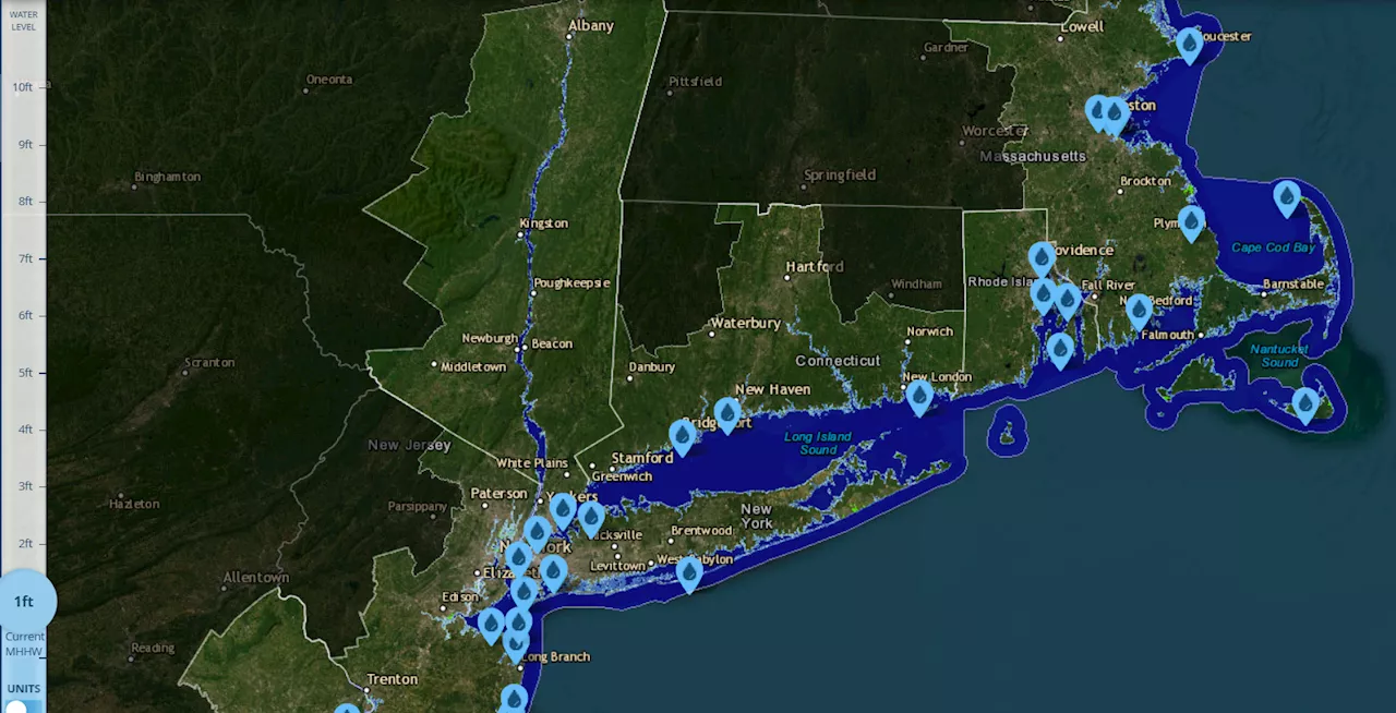 Connecticut Map Shows Where State Could Be Underwater From Sea Level RiseProjections show that rising sea levels could encroach on several areas of the state.
Read more »
 Map Shows Florida Cities Hit New Record Heat: 'Scorcher'The Sunshine State faced its first heat wave of the season this week. Daily record high temperatures were reached in several cities in southwest Florida.
Read more »
 Social Security Map Shows 10 Cities With Highest Benefit IncomeA recent study by SmartAsset revealed the cities with the highest Social Security income.
Read more »
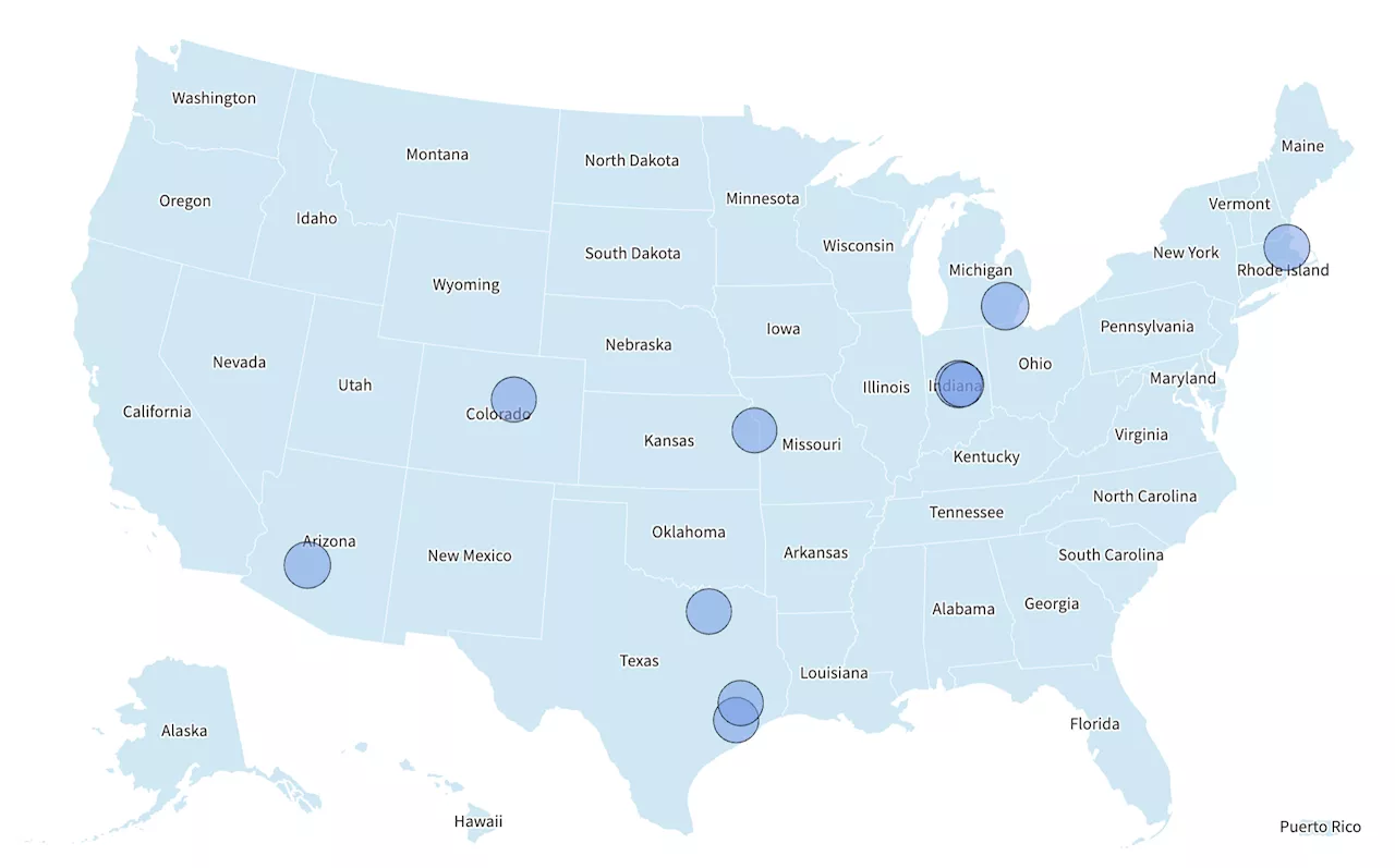
 Texas Power Outage Map Shows 700,000 People Without ElectricityMore damage and widespread power outages are expected to occur overnight.
Read more »
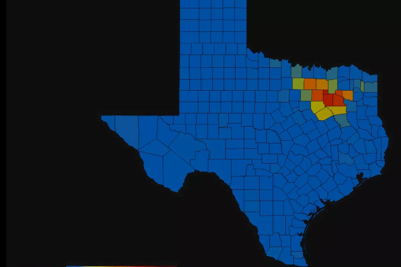
 Map Shows Texas Cities Under Threat From Severe StormsResidents have been warned that more thunderstorms, wind gusts to 70 mph and 'golf ball sized hail' are set to batter parts of the state.
Read more »