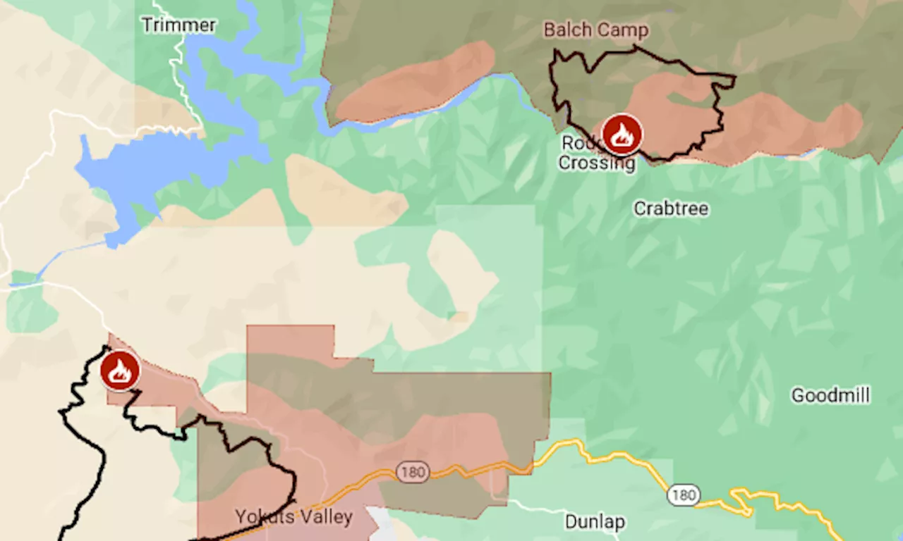
The merged Bolt and Flash fires are now the fourth biggest of California’s season.
The largest of the fires is the combined Bolt and Flash, which started on Monday, June 24, and merged on Wednesday. That fire is part of the Fresno June Lightning Complex, which as of Thursday night had an area of 10,669 acres , said the California Department of Forestry and Fire Protection. That puts it at fourth biggest of California’s wildfire season, after Sites, Post and Corral.
Ten miles to the northeast, the Basin Fire was reported Wednesday morning in the Sierra National Forest. By Thursday night, it had burned 5,692 acres , CalFire said. The map above shows the approximate perimeters of the fires as a black line and the mandatory evacuation areas in red. For more details of the evacuations, including areas under warning, seeAn evacuation shelter has been set up at Reedley College . Small pets will be accepted at the Reedley site; large animals can be taken to the fairgrounds in Fresno .
Ask Amy: I'm insisting that my wedding guests wear only yellow and don't speak, even at the receptionAsk Amy: How can I tell these flirty men that I stick to my own kind?Dear Abby: I overlooked my friend's bad behavior, until she turned on meKurtenbach: Instant reaction to the Warriors' second-round pickShiny monolith mysteriously appears on dairy farm in Northern Colorado
Report: Baltimore’s $1,000 monthly cash assistance program helps with income, housing independence, mental health
United States Latest News, United States Headlines
Similar News:You can also read news stories similar to this one that we have collected from other news sources.
 Point Fire map: Evacuations in Sonoma County wine countryThe approximate perimeter is indicated by the black line and the mandatory evacuation area by the red tint.
Read more »
 Arapahoe Basin sets closing day for 2024 ski seasonArapahoe Basin will be open for two more weekends of skiing and riding, resort officials announced Monday in setting a new closing date of June 16.
Read more »
 Tangled up with debris -- Parma addresses Tanglewood Lane basin issueDetention basins play a key role in stormwater management; however, accessibility for maintenance is a priority.
Read more »
 Study reveals spatiotemporal changes of ecosystem services in the Aral Sea basinThe Aral Sea, located in Central Asia, has been shrinking in surface area due to climate change and human activities. This shrinkage has caused a regional ecological crisis, significantly affecting the key ecosystem services in the region.
Read more »
 Firefighter injured fighting fire in Sepulveda Basin homeless encampmentIt happened Monday afternoon in the 15700 block of West Burbank Boulevard
Read more »
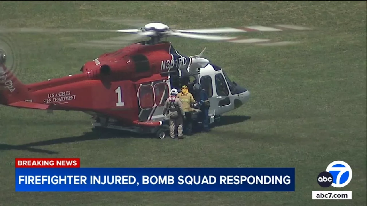 LAFD firefighter injured in explosion en route to fire at homeless encampment in Sepulveda BasinA Los Angeles firefighter was critically injured after an explosion occurred as crews were headed to the scene of a brush fire on Monday.
Read more »