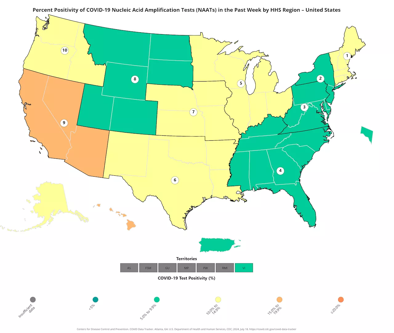
Southwestern states, such as Nevada where Joe Biden tested positive on Wednesday, are showing the highest infection rates.
President Joe Biden is not alone; a new map shows southwestern states are seeing the highest rates of COVID-19 infection across the country.The president canceled an appearance in Las Vegas, Nevada, yesterday after testing positive for the disease, which has been on the rise nationwide for the last two months.The latest data on positive COVID-19 tests across the U.S.
Although no other states recorded over 15 percent infection, five regions recorded an infection rate higher than 10 percent.In Region Six, including Arkansas, Louisiana, New Mexico, Oklahoma, and Texas, the rate of new infections was 14 percent.In Region Ten, including Alaska, Idaho, Oregon, and Washington, the rate of new infections was 12.5 percent.In Region Seven, including Iowa, Kansas, Missouri, and Nebraska, the rate of new infections was 11 percent.
United States Latest News, United States Headlines
Similar News:You can also read news stories similar to this one that we have collected from other news sources.
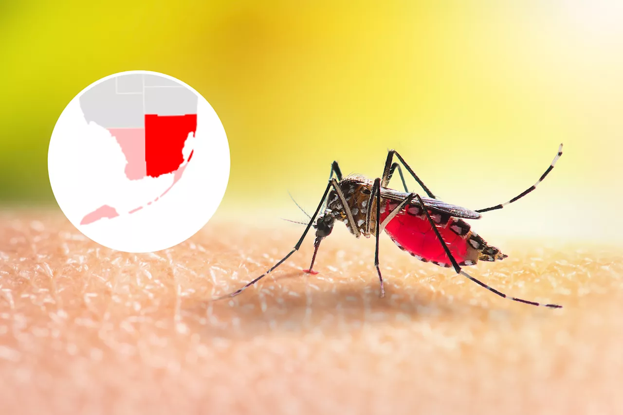 Map Shows Florida Dengue Cases After Health WarningA mosquito alert has been issued after two new locally acquired cases were reported in Monroe County.
Read more »
 Map shows states where COVID levels are 'high' or 'very high' as summer wave spreadsNationwide, the CDC says the COVID virus level in wastewater is now 'high' for the first time since last winter.
Read more »
 Map Shows Only State Where it's OK to Text and DriveAs of August 2023, only one U.S. state still allows drivers to use their cellphone while on the road.
Read more »
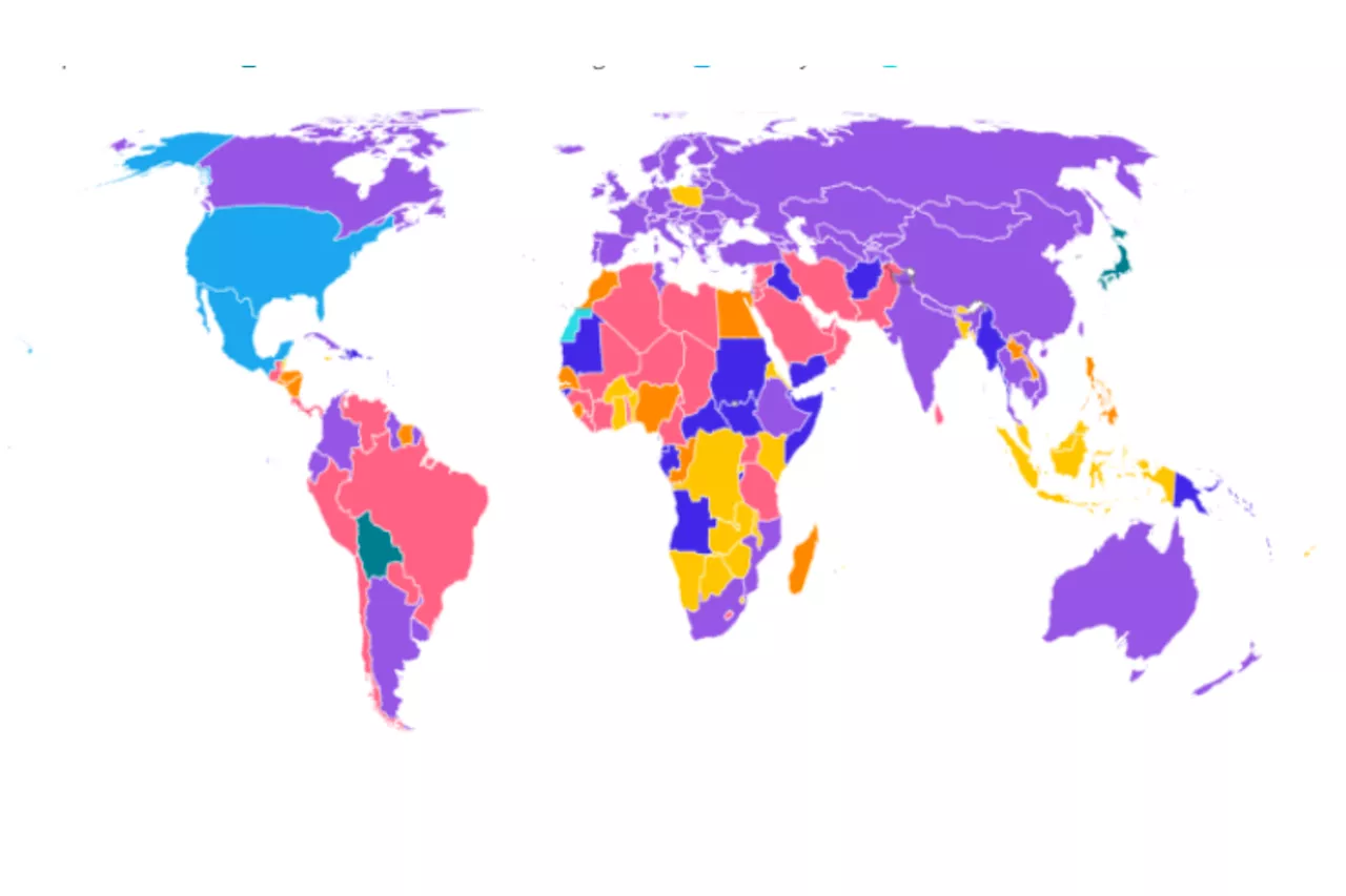 Abortion Map Shows Countries With Tougher Rules Than Any US StateMap shows countries where having an abortion is punishable by a prison sentence amid protests in Brazil over abortion rights.
Read more »
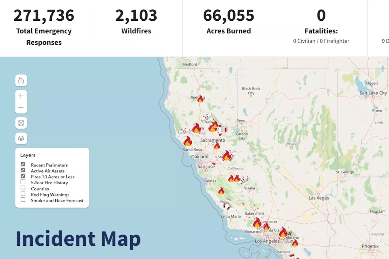 California Fire Map Shows 36,145 Acres Burned as Wildfires SpreadThe largest fire was the Post Fire burning in Los Angeles and Ventura counties. More than 15,000 acres have burned.
Read more »
 Map Shows City Hit Record Amid 'Extreme' Heat WaveThe area could reach 'heat index values of 100F to 110F' on multiple days this week, according to the National Weather Service.
Read more »