
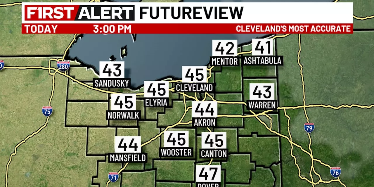
Northeast Ohio residents can expect a mix of milder temperatures and strong winds over the coming days. While temperatures will start in the teens, they will climb into the low 30s by afternoon. Snow chances are low, with the best opportunity for light snowfall south of Cleveland later this afternoon. Strong winds are expected, particularly on Monday, with gusts reaching over 40 mph.
Temperature s will begin the day in the teens, feeling close to zero degrees due to wind chill. However, afternoon highs will climb into the low 30s, pushing wind chill values up to the low 20s. A southerly wind will shift to a southwesterly direction later in the day. Sustained wind speeds will range between 10 and 20 mph, with occasional gusts reaching up to 30 mph. This wind could start to break up ice near the Lake Erie shoreline, so it is crucial to avoid venturing onto the ice.
Snow chances are generally decreasing due to the presence of very dry air. There might be a couple of snow showers moving off the lake and affecting parts of the lakeshore east of Cleveland this morning. Otherwise, the best opportunity for snow will be south of Cleveland, closer to the US 30 corridor, later this afternoon. Tonight, expect mostly cloudy skies with a few flurries or a couple of light snow showers. Temperatures will drop to the mid-20s.Monday will bring dry conditions and windy weather under abundant sunshine. High temperatures will rise a degree or two above freezing, reaching the mid-30s. Winds may occasionally gust over 40 mph
WEATHER FORECAST TEMPERATURE WIND SNOW LAKE ERIE
United States Latest News, United States Headlines
Similar News:You can also read news stories similar to this one that we have collected from other news sources.
 Northeast Ohio Weather Forecast: Rainy New Year's Eve Transitioning to SnowA departing weather system brings sunshine and mild temperatures for the remainder of the day. However, rain is expected on New Year's Eve, transitioning to snow overnight as temperatures drop. The new year begins with lingering snow showers and a prolonged cold spell.
Read more »
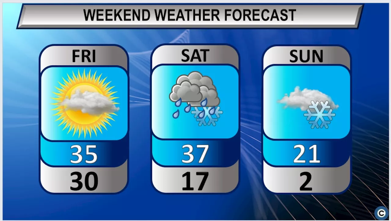 Northeast Ohio weekend weather forecast features warmer temperatures before dangerous cold returnsNortheast Ohio's forecast for this weekend calls for highs in the upper 30s on Saturday, but lows Sunday night will be in the single digits.
Read more »
 Central Ohio Weather Forecast: Wind Advisory, Rain, and Potential for Severe WeatherCentral Ohio is under a Wind Advisory as strong winds accompany rain. A cold front will bring more showers and isolated thunderstorms, with a low risk of severe weather in North and East Ohio. Temperatures will remain mild for now, but a colder start to 2025 is expected with potential for snow flurries.
Read more »
 Northeast Ohio forecast: Intermittent snow, cold temperatures aheadThe National Weather Service predicts occasional snow showers and chilly conditions for the Cleveland area through the middle of next week.
Read more »
 Chilly Weather Expected in Northeast OhioForecasters predict cold temperatures and potential snow for Northeast Ohio throughout the week, with the coldest days expected on Tuesday and Wednesday. Ashtabula County is under a winter storm watch.
Read more »
 Northeast Ohio Weather: Arctic Air and Lake Effect Snow ExpectedA cold front brought colder temperatures and wind gusts to Northeast Ohio. Lake effect snow showers are possible from Euclid to Conneaut, with heavier snow expected east of Cleveland. Dangerous cold air and wind chills are expected tomorrow.
Read more »