Mark Johnson has been News 5's Chief Meteorologist since 2003.
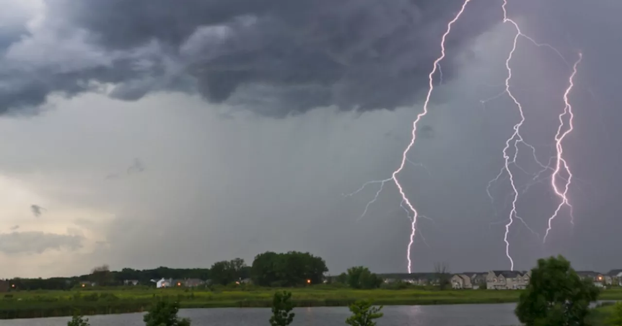
We hit the lower 90s Wednesday and we'll do it again today. We'll also have to dodge a few strong thunderstorms, very similar to Wednesday. Heavy rain, frequent lightning, and strong winds are the main threats. May even cause damage. Where we break off from Wednesday's forecast is this evening. Storms faded last night. More storms are heading our way for this evening and overnight. These storms linger all night and into Friday before we dry out late in the day.
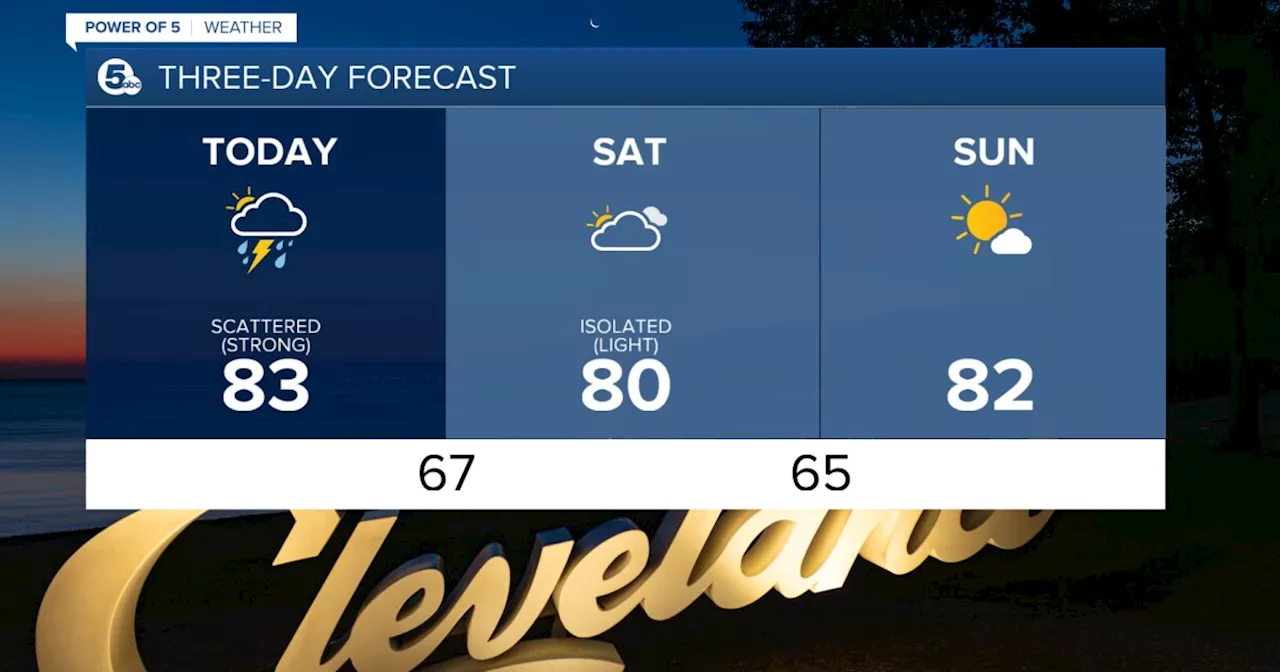
What To Expect:Heat & humidity crankingStorm chances increase from Thursday PM into FridayStaying warm, humid, and unsettled through the weekendBetter chance for storms on Saturday compared to SundayDaily Breakdown:Thursday: PM scattered storms. | High: 90°Friday: Scattered storms. | High: 82°Saturday: Scattered storms. | High: 80°Sunday: Mostly sunny. Not as humid. | High: 84°Monday: Isolated storms.
Cleveland Forecast Forecast Northeast Ohio Forecast Northeast Ohio Weather Power Of 5 Weather
United States Latest News, United States Headlines
Similar News:You can also read news stories similar to this one that we have collected from other news sources.
 Summer heat & humidity coming to town for the 4th of July holiday weekendMark Johnson has been News 5's Chief Meteorologist since 2003.
Read more »
 Mother Nature bringing her own fireworks for Independence DayMark Johnson has been News 5's Chief Meteorologist since 2003.
Read more »
![]() Tracking heat, humidity and thunderstorms for our Fourth of July celebrationsMark Johnson has been News 5's Chief Meteorologist since 2003.
Tracking heat, humidity and thunderstorms for our Fourth of July celebrationsMark Johnson has been News 5's Chief Meteorologist since 2003.
Read more »
 Heading through the 4th of July holiday weekend with more stormsMark Johnson has been News 5's Chief Meteorologist since 2003.
Read more »
 Soaring into the new work week with soaring tempsMark Johnson has been News 5's Chief Meteorologist since 2003.
Read more »
 Beryl's impacts coming in waves of rain and windMark Johnson has been News 5's Chief Meteorologist since 2003.
Read more »