
California continues to experience high wildfire activity this summer with temperatures slated to remain above normal this week in parts of the fire-prone…
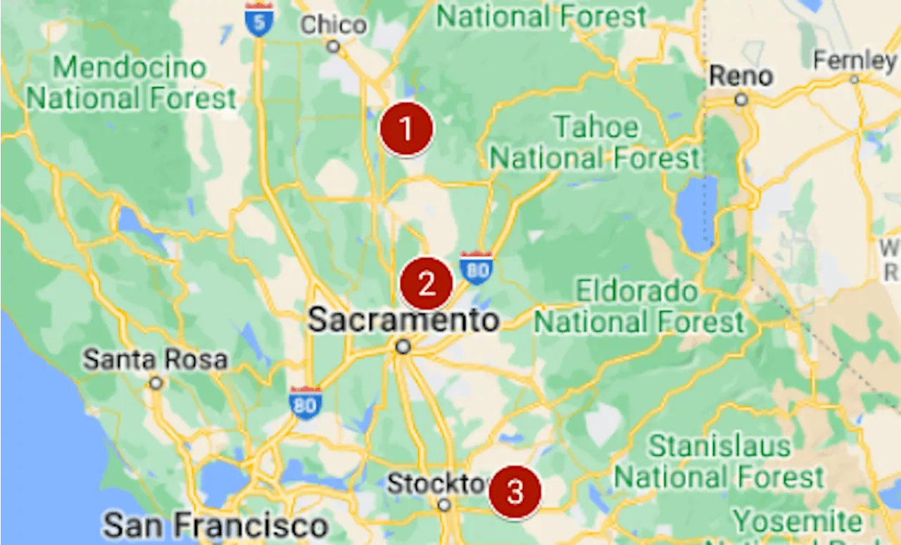
Today's breaking news on wildfires in California, SoCal and Los Angeles. Here is the latest on fires now, including breaking developments, public safety information, maps, video and longterm outlooks.California continues to experience high wildfire activity this summer with temperatures slated to remain above normal this week in parts of the fire-prone state.Cal Fire has reported 3,422 wildfires at 169,516 acresEstimated Monday at 20,320 acres, the Lake Fire began Friday afternoon.
Cal Fire reports that the fire has been 60% contained as of Monday. Its cause is still under investigation.The North Fire began on Sunday in Northeast California, near Highway 395. The fire is currently estimated at 4,380 acres.Beginning on July 2 near Oroville in Butte County, the Thompson fire is currently estimated at 3,789 acres and is 98% contained.The Shelly Fire in Siskiyou County at the northern edge of California, is currently estimated at 3,380 acres.
United States Latest News, United States Headlines
Similar News:You can also read news stories similar to this one that we have collected from other news sources.
 Beach Map Shows States With Fourth of July Fecal Bacteria WarningsSeveral beaches across parts of Florida, Illinois, Michigan, New Jersey and New York are closed or under advisories.
Read more »
 Interactive Hudson County map shows all road closures planned for July 4 festivities, fireworks viewingThe web page allows the user to zoom in on a street and click on the red line that signifies the road closure to find more information regarding that closure.
Read more »
 Map shows states where fireworks are legal or illegal on July 4, 2024Ahead of July 4, here are the states where fireworks sales are legal, where they're illegal and where various restrictions apply.
Read more »
 Macy's 4th of July fireworks Hudson River map, where not to watchThe display will launch along the Hudson River for the first time in nearly a decade. Here are some tips before you go including areas to avoid, and what to bring with you.
Read more »
 Map: Biggest of the California wildfires that started amid Monday’s lightningEvacuations were ordered for the Apache Fire, near Oroville.
Read more »
 Map: Where are California’s big wildfires, and how contained are theyThe two biggest had passed 15,000 acres.
Read more »