
Fire crews from Lancaster and Lebanon counties battled a blaze at a South Londonderry Township warehouse for approximately 8 hours early Saturday.
A three-alarm fire damaged a warehouse in South Londonderry Township early Saturday morning as first responders spent approximately eight hours at the scene.
Crews from Lancaster and Lebanon counties were dispatched to Airport Road in South Londonderry Township, Lebanon County, around midnight for the fire.said smoke and fire were coming through the warehouse’s roof when their crews arrived. Low visibility and high heat inside forced firefighters outside the burning commercial structure.
The fire was upgraded to a third alarm for additional manpower and a tanker task force due to “mass water flow,” the Campbelltown Fire Company’s post said. Crews were at the scene for approximately eight hours. It is unclear if anyone was injured as a result of the fire.Machete-armed bank robbery suspect dies after being shot by Lancaster police: DA
If you purchase a product or register for an account through a link on our site, we may receive compensation.and agree that your clicks, interactions, and personal information may be collected, recorded, and/or stored by us and social media and other third-party partners in accordance with our
Fire Lebanon-County South-Londonderry-Township Lancaster-County
United States Latest News, United States Headlines
Similar News:You can also read news stories similar to this one that we have collected from other news sources.
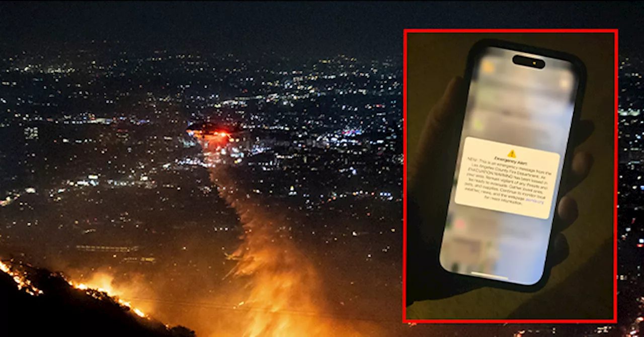
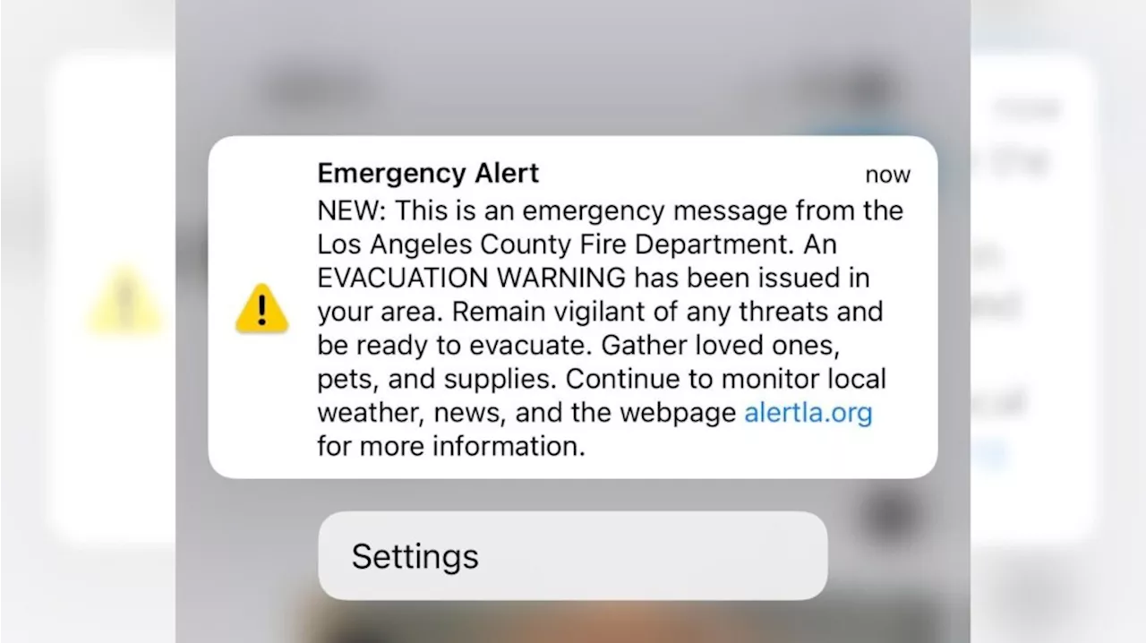 LA County Fire mistakenly sends out emergency evacuation alert to entire countyThe alert caused many residents, already tense, to fear their homes were now in danger, too.
Read more »
 Los Angeles County Fire Department Accidentally Sends Evacuation Alert to All of L.A. CountySource of breaking news and analysis, insightful commentary and original reporting, curated and written specifically for the new generation of independent and conservative thinkers.
Read more »
 LA County Fire mistakenly sends out emergency evacuation alert to entire countyAnother alert was issued shortly after announcing that it was only for areas near West Hills.
Read more »
 Map: See where Los Angeles County wildfires are burningThe Palisades Fire, Eaton Fire, Hurst Fire, Lidia Fire and Sunset Fire are burning Friday in Los Angeles County. See updates and locations.
Read more »
 Cal Fire's Fire Hazard Severity Zone Map Shows California Fire RiskCal Fire's new Fire Hazard Severity Zone map allows Californians to search for an address and see the location's probability of being affected by fire. The map assesses fire hazard, rather than risk, based on the physical conditions that create a likelihood of fire behavior over a 30 to 50-year period. The map considers terrain, local weather, and fire history over 50 years. Areas are ranked as moderate, high, or very high fire severity. The map is effective as of April 1, 2024 and focuses on areas under state responsibility, excluding federal land like the Sierra Nevada Mountains and some parts of the Bay Area.
Read more »
 Cal Fire's Fire Hazard Severity Zone Map Helps Californians Assess Fire RiskCal Fire's new Fire Hazard Severity Zone map allows residents to search for an address and see the location's probability of being affected by fire. This map focuses on fire hazard, not risk, and considers factors like terrain, weather, and fire history.
Read more »