
A brush fire ignited near the CSU Channel Islands campus in Oxnard, California, fueled by dry conditions and strong winds. Firefighters and water-dropping aircraft battled the blaze, which spread rapidly across 15 acres of medium brush.
Firefighters and water-dropping aircraft responded to the Laguna Fire at about 9 a.m. off Laguna Road in the Oxnard plains. The fire was estimated at 15 acres with a rapid rate of spread in medium brush.Water-dropping aircraft responded to the hillside covered in dry brush, located just west of the CSU Channel Islands campus and about 60 miles west of downtown Los Angelesis on scene of an approximately 2 acre brush fire off of Laguna Road in the Oxnard plains.
Under a red flag warning, any fires that do start are more likely to spread at a rapid rate behind strong winds. Flying embers also speed a brush fire's spread. Powerful gusts can cast hot embers for miles, starting spot fires ahead of the main fire line in a nightmare scenario for firefighters.
WILDFIRE RED FLAG WARNING VENTURA COUNTY CALIFORNIA BRUSH FIRE
United States Latest News, United States Headlines
Similar News:You can also read news stories similar to this one that we have collected from other news sources.
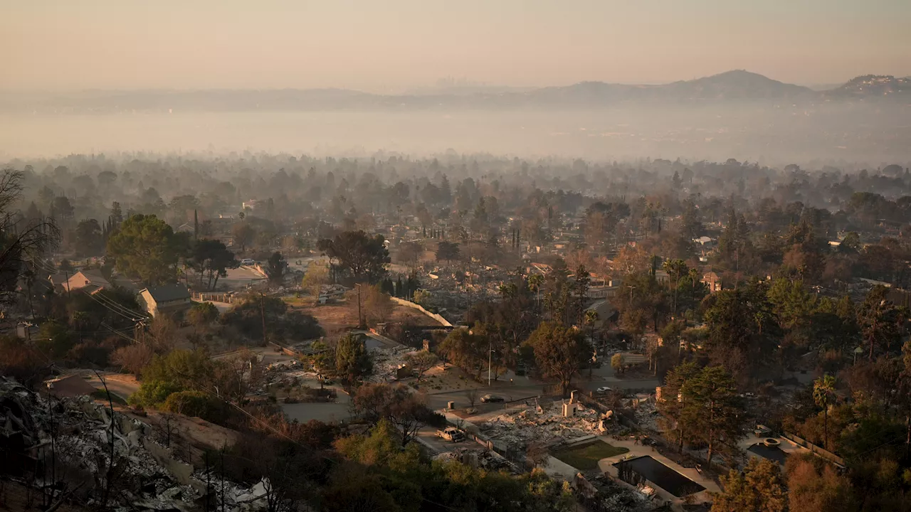
 Los Angeles fire captain races to save own home, 3 others from Eaton FireLA Fire Capt. Dan Lievense opens up about trying to save his home and his neighbors' homes in Altadena from the Eaton Fire.
Read more »
 Los Angeles fire captain races to save own home, 3 others from Eaton FireLA Fire Capt. Dan Lievense opens up about trying to save his home and his neighbors' homes in Altadena from the Eaton Fire.
Read more »
 Cal Fire's Fire Hazard Severity Zone Map Shows California Fire RiskCal Fire's new Fire Hazard Severity Zone map allows Californians to search for an address and see the location's probability of being affected by fire. The map assesses fire hazard, rather than risk, based on the physical conditions that create a likelihood of fire behavior over a 30 to 50-year period. The map considers terrain, local weather, and fire history over 50 years. Areas are ranked as moderate, high, or very high fire severity. The map is effective as of April 1, 2024 and focuses on areas under state responsibility, excluding federal land like the Sierra Nevada Mountains and some parts of the Bay Area.
Read more »
 Cal Fire's Fire Hazard Severity Zone Map Helps Californians Assess Fire RiskCal Fire's new Fire Hazard Severity Zone map allows residents to search for an address and see the location's probability of being affected by fire. This map focuses on fire hazard, not risk, and considers factors like terrain, weather, and fire history.
Read more »
 Map: See where Los Angeles County wildfires are burningThe Palisades Fire, Eaton Fire, Hurst Fire, Lidia Fire and Sunset Fire are burning Friday in Los Angeles County. See updates and locations.
Read more »
 Getty Villa Evacuates as Palisades Fire Races NearbyThe Getty Villa in Pacific Palisades narrowly escaped damage from the fast-moving Palisades fire on Tuesday. While some trees and vegetation burned, the museum's rare artifacts and staff remained safe thanks to extensive fire mitigation efforts and preventative measures.
Read more »