The Palisades Fire and the Eaton Fire also remain active.
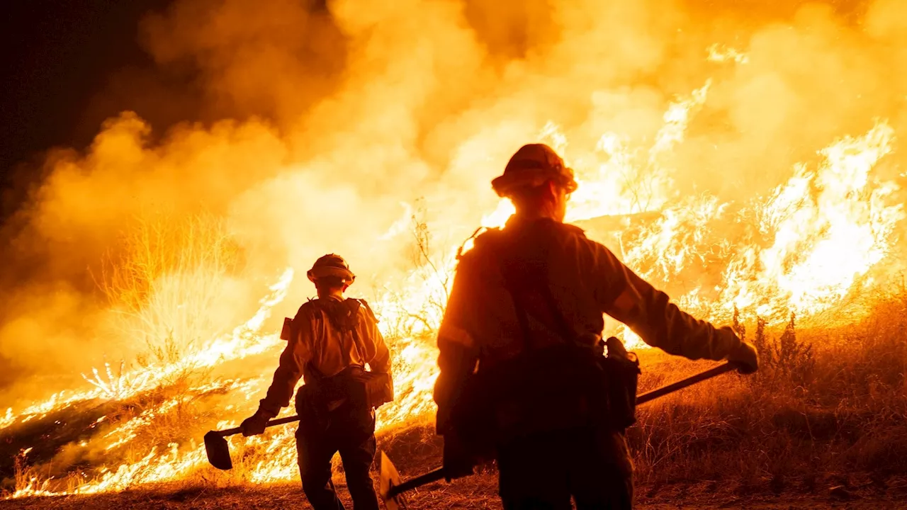
Thousands of firefighters have been battling wildfires across 45 square miles of densely populated Los Angeles County. The two largest fires, the Palisades Fire in Pacific Palisades and the Eaton Fire near Pasadena, remain active.
The Palisades Fire, which began in the Pacific Palisades on Jan. 7, has destroyed or damaged more than 6,000 structures. It's covered more than 23,700 acres and is at 68% containment. The fire chief said the light to moderate Santa Ana winds are continuing to spread the blaze, but so far, no structures have been damaged or destroyed.
United States Latest News, United States Headlines
Similar News:You can also read news stories similar to this one that we have collected from other news sources.
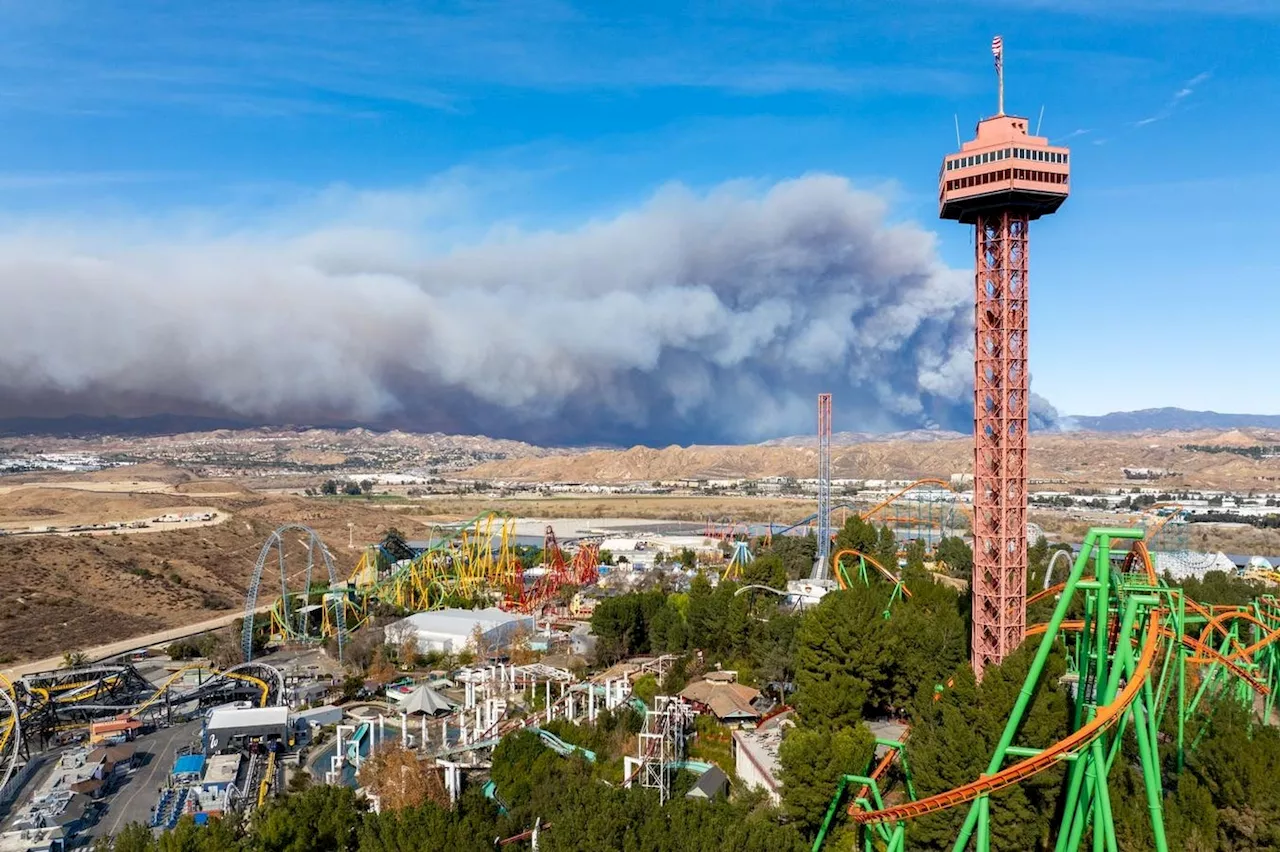 California Wildfire Updates: New Hughes Fire Explodes To 5,000 Acres In Northern Los Angeles CountyThe fire is rapidly spreading amid a red flag warning in the region.
Read more »
 New Fire Breaks Out in Ventura County Amidst California WildfiresFirefighters in Ventura County are battling a new wildfire, dubbed the Auto fire, as strong winds threaten containment efforts on massive blazes burning throughout the Los Angeles area.
Read more »
 Cal Fire's Fire Hazard Severity Zone Map Shows California Fire RiskCal Fire's new Fire Hazard Severity Zone map allows Californians to search for an address and see the location's probability of being affected by fire. The map assesses fire hazard, rather than risk, based on the physical conditions that create a likelihood of fire behavior over a 30 to 50-year period. The map considers terrain, local weather, and fire history over 50 years. Areas are ranked as moderate, high, or very high fire severity. The map is effective as of April 1, 2024 and focuses on areas under state responsibility, excluding federal land like the Sierra Nevada Mountains and some parts of the Bay Area.
Read more »
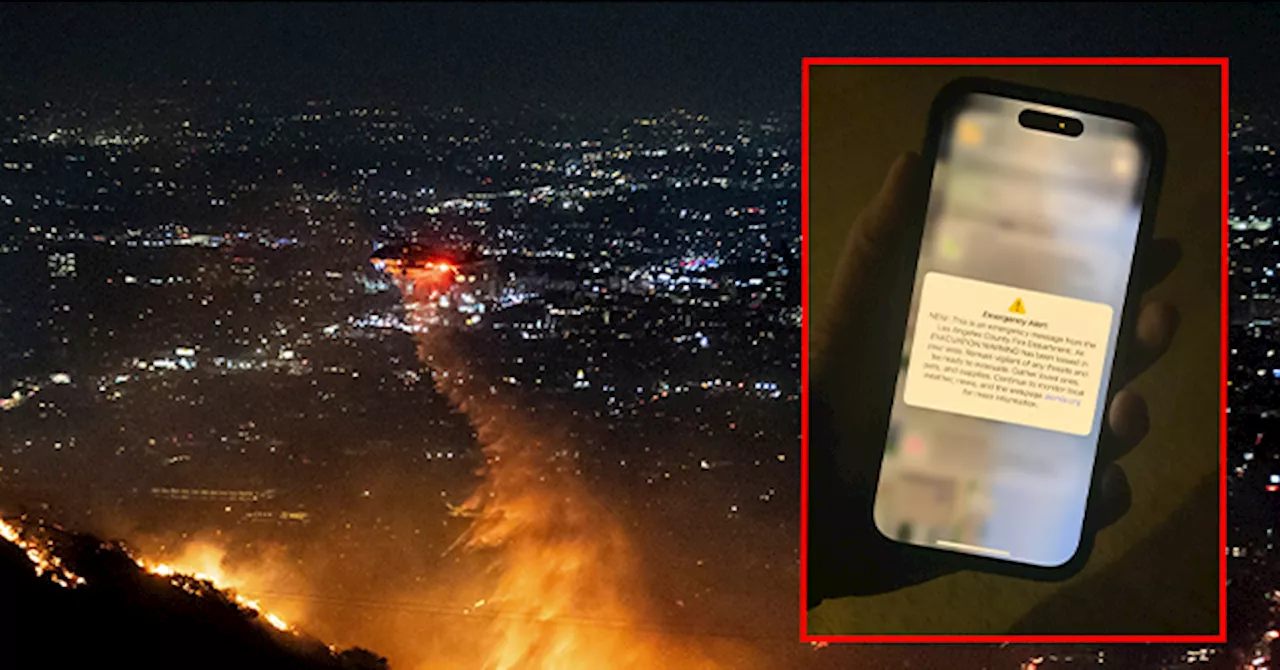
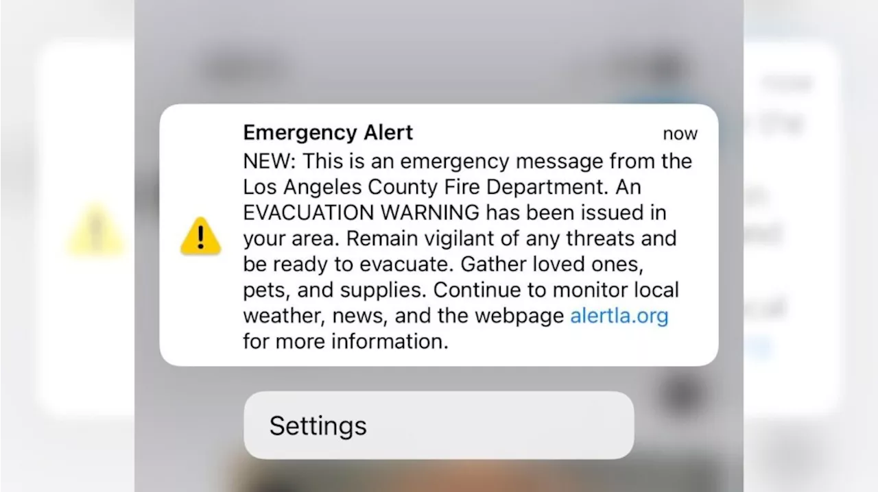 LA County Fire mistakenly sends out emergency evacuation alert to entire countyThe alert caused many residents, already tense, to fear their homes were now in danger, too.
Read more »
 Los Angeles County Fire Department Accidentally Sends Evacuation Alert to All of L.A. CountySource of breaking news and analysis, insightful commentary and original reporting, curated and written specifically for the new generation of independent and conservative thinkers.
Read more »
 LA County Fire mistakenly sends out emergency evacuation alert to entire countyAnother alert was issued shortly after announcing that it was only for areas near West Hills.
Read more »