
Satellite images show the largest methane emitters in California are landfills... far more than the oil and gas sector or dairy farms. But the solution to that problem might already be in place.
Satellite images show the largest methane emitters in California are landfills... far more than the oil and gas sector or dairy farms. But the solution to landfills' greenhouse emissions problem might already be in place.
Solid waste has produced limited amounts of renewable natural gas at the Victor Valley landfill for years, but last year the facility repurposed these 330,000 gallon digesters to process food waste which is delivered to the facility by truck. Becoming the first wastewater treatment plant in the state to inject renewable natural gas made from wastewater solids and food waste into a utility pipeline.
It's in upgrader that the raw biogas is scrubbed of impurities and pipeline quality renewable gas is created and injected into the southwest gas system.
United States Latest News, United States Headlines
Similar News:You can also read news stories similar to this one that we have collected from other news sources.
 Satellite image shows smoke engulfing U.S. East CoastSmoke from wildfires blazing in Quebec has blanketed New York City, turning the skies a rusty-orange color.
Read more »
 Phew, California's Largest Reservoir is Nearly FullCalifornia residents will be glad to know their reservoirs are nearly full again after years of drought. New satellite photos show the levels of Shasta Lake, California’s largest reservoir, going from 31% capacity last November to nearly 100% in May 2023. The reservoir was filled with heavy rains and a significant mountain snowpack that melted … Continue reading 'Phew, California’s Largest Reservoir is Nearly Full'
Read more »
 New tool 'cleans' ever-increasing satellite trails from Hubble photos'Even as the number of satellites increases over the decade, these tools for cleaning the images will still be applicable.'
Read more »
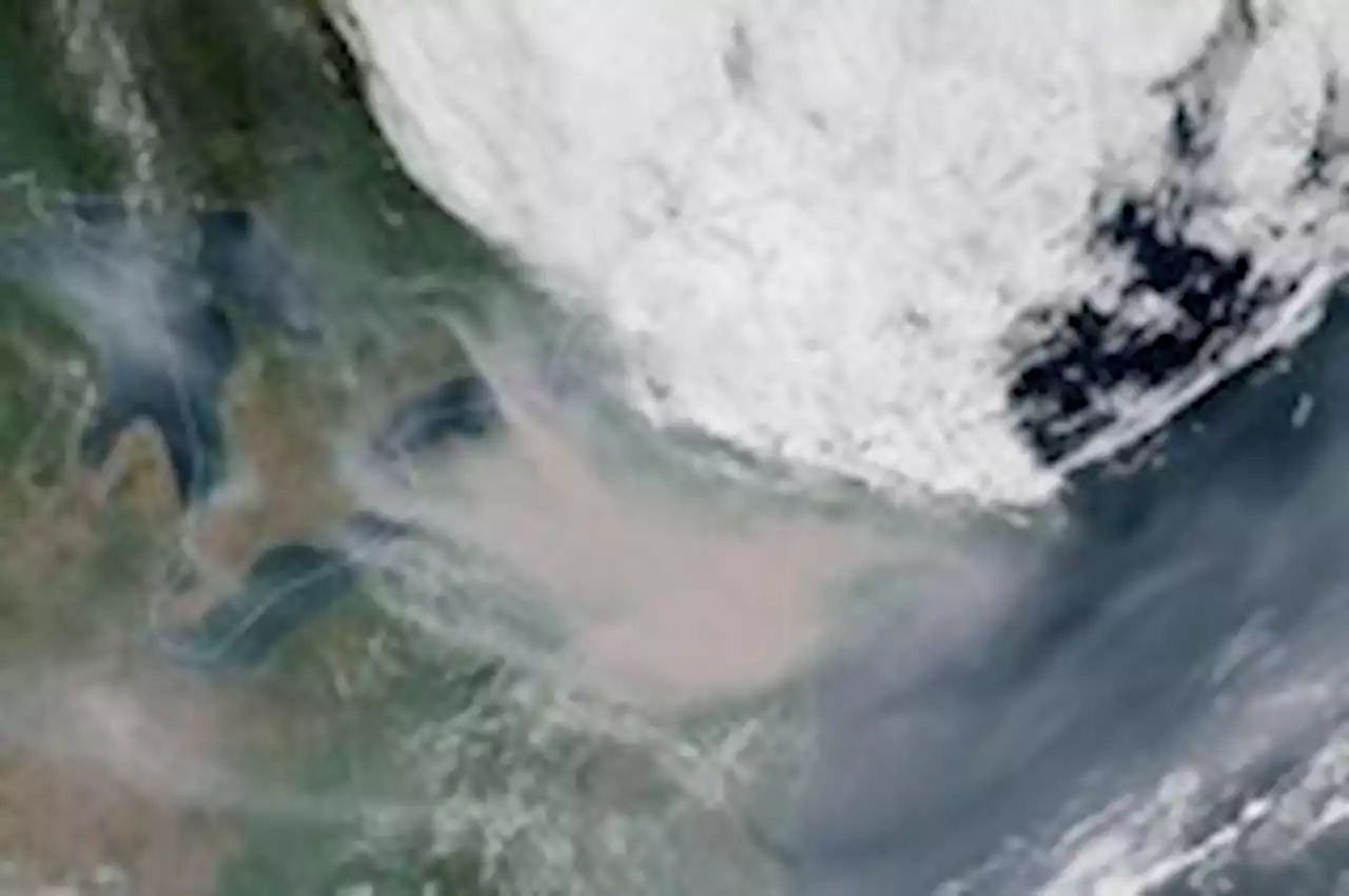 Satellite images show wildfire smoke creeping from Canada across U.S.Satellite imagery and animations show how wind and weather patterns carried thick plumes of smoke across the United States.
Read more »
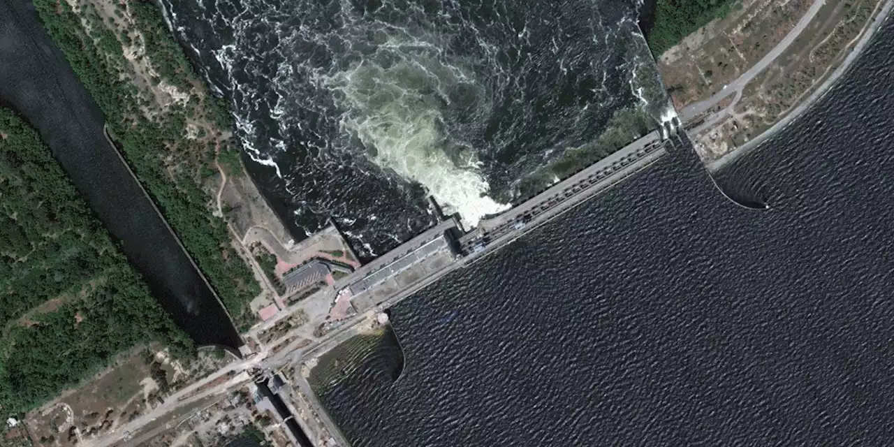 Satellite images show the scale of the Ukraine dam destructionPhotos from before and after the disaster — captured by Maxar Technologies and released Thursday — show how the landscape across southern Ukraine has been reshaped.
Read more »
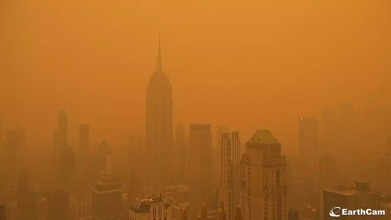 Canada wildfires: Satellite photos show massive smoke plumes engulfing the US East CoastCurrently, over 400 fires have been reported throughout Canada. The most severe fires have been recorded in the Canadian provinces of Quebec and Nova Scotia.
Read more »